Page Not Found
Sorry, the page you requested could not be found.
You might find what you are looking for here:
Plan Your Visit
Highlights
Private Tour to Newgrange, Knowth, and the Boyne Valley
Embark on a journey through time and heritage with our exclusive private tour to Newgrange, Knowth, and other captivating sites nestled in the enchanting Boyne Valley. Immerse yourself in the rich history and mystique of these World Heritage sites, where ancient wonders come to life.
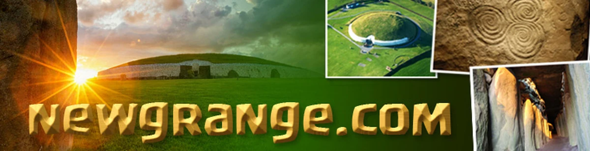
Newgrange and Knowth, both designated as UNESCO World Heritage sites, stand as testament to the ingenuity of our ancestors. Dating back over 5,000 years, these Neolithic passage tombs are older than Stonehenge and the Great Pyramids of Giza. Step inside the chambers of Newgrange, where the winter solstice illuminates a narrow passage, casting an ethereal light on the ancient carvings within. Explore Knowth, adorned with megalithic art, and unravel the mysteries of a bygone era.
Visit the megalithic passage tombs at Newgrange and Knowth with the on-site guide. These are UNESCO World Heritage sites so you will be joining others on the official tour. Beyond the renowned Newgrange and Knowth, our private tour takes you on an intimate exploration of lesser-known gems in the Boyne Valley.
Leave the logistics to us as you embark on a stress-free exploration of the Boyne Valley. Our private tours ensure a personalized and comfortable experience from the moment we pick you up at your accommodation to the time we drop you back.