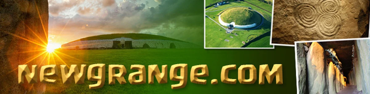
Brú na Bóinne World Heritage Site Research Framework
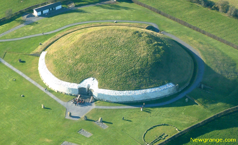 Newgrange - Brú na Bóinne World Heritage Site.
The Research Framework document was commissioned and funded by the Department of the Environment, Heritage and Local Government and prepared by The Heritage Council. It incorporates the work of numerous contributors who attended the meetings and workshops and all are thanked for their contributions and comments.
Excerpt from Brú na Bóinne World Heritage Site Research Framework
Brú na Bóinne in context
The Brú na Bóinne or Bend of the Boyne, World Heritage Site is located in county Meath on the east coast of Ireland (National Grid Reference 3008 2727), 4.8km west of the medieval port of Drogheda and approximately the same distance east of the 18th century village of Slane.
The local geology is one of Carboniferous limestone lowlands with overlying shale hills and the site is centred on a dramatic loop in the lower course of the Boyne river on its way to the sea some 10km away. An 'island' effect is created by the course of a second river, the Mattock, which effectively encloses the area to the north of the Boyne.
Within the bend itself, the land is dominated by an east-west shale ridge upon which the well-known large passage tombs of Newgrange, Knowth and Dowth are situated. An additional 90 recorded monuments - as well as an unknown quantity of as yet unrecorded sites - are also scattered across this ridge and over the low-lying areas and floodplain closer to (the present course of) the rivers.
Deep glacial deposits cover the area and have created a variety of fertile soils, which likely offered some protection from the excesses of rainfall or drought through the millennia (Mitchell, Eogan and Roche 1997, 6). Today, the WHS is a mosaic of mixed farmland ranging from intensive arable to permanent pasture, with many of the hedgerows and old field boundaries remaining in place alongside patches of deciduous woodland. The WHS also encompasses several Natural Heritage Areas (NHAs) - Crewbane Marsh, Rossnaree Riverbank, Dowth Wetlands and the Boyne River Islands. This last is one of 364 Special Areas of Conservation (SAC) sites in the country and one of the few examples in the State of alluvial wet woodland - a priority habitat under the EU Habitats Directive. The Boyne river has in addition been designated a Salmonid River under the EU Freshwater Fish Directive.
International importance
The oldest recorded monuments in the Brú na Bóinne World Heritage Site are the Neolithic tombs and the Boyne area is widely seen as having one of the most significant complexes of passage tombs in Europe both in terms of the scale, complexity and numbers of the monuments themselves, and in terms of the wealth of material evidence that accompanies them.
The Brú na Bóinne tombs, and in particular Knowth, contain the largest assemblage of megalithic art in Western Europe. While today these prehistoric monuments are nationally and internationally the most well known aspect of the WHS, we should not forget the central position of the Brú na Bóinne area as a whole has occupied. From prehistory, to the arrival of Christianity and St. Patrick, and the power struggles of 17th century Europe, this landscape has come to reflect in microcosm many of the processes that have shaped society on the island and the wider world over the past millennia.
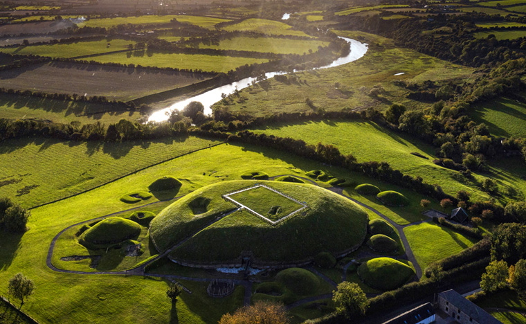 Knowth and the River Boyne | Brú na Bóinne World Heritage Site.
Background to inscription
In December 1985, at the instigation of the Royal Irish Academy, a committee comprising representatives from Meath County Council, the Office of Public Works, Bord Fáilte, the National Museum and UCD recommended that an Archaeological Park be established at Brú na Bóinne, an initiative approved by the State in 1987. A specialist landscape and planning consultant, Anthony O'Neill, was commissioned to undertake a study of the planning issues involved, notably visitor facilities, access and interpretation (O'Neill 1989).
A core area comprising land immediately within the bend of the river (approximately 780 hectares) and a buffer zone situated between the core area and the Mattock river to the north (an additional 700 hectares) had already been proposed by the committee. O'Neill recommended that a southern buffer zone be added to the boundary of the proposed Archaeological Park, extending to the ridgeline of an escarpment that overlooked the core area. The sun's alignment to Newgrange came over this ridgeline and the escarpment was an important visual landform when viewed from the core area.
O'Neill also felt that the River Boyne was an integral part of Brú na Bóinne and should lie within a zone of development control and not on the edge of the park boundary. The total buffer zone was thus extended to 2500 hectares, the boundary lines respecting carefully mapped views into and out of the core area. Sometimes these lines followed contours, watercourses or field boundaries, but mostly the modern routeways of the area were used, the line drawn some distance back from roads and junctions to discourage linear development. These boundaries of the Boyne Valley Archaeological Park, encompassing a total area of approximately 3300 hectares, were to become the boundaries of the future World Heritage Site.
Ireland ratified the World Heritage Convention on the 16th September 1991, nominating the 'Archaeological ensemble of the Bend of the Boyne' for inscription on the World Heritage List a year later. Following an ICOMOS evaluation, the property was inscribed by the World Heritage Committee in December 1993.
The 'Archaeological ensemble of the Bend of the Boyne' was judged to be of outstanding universal value, meeting three of the six criteria for cultural heritage ([i] represents a masterpiece of human creative genius; [iii] bears a unique or at least exceptional testimony to a cultural tradition or to a civilization which is living or which has disappeared; [iv] is an outstanding example of a type of building, architectural or technological ensemble or landscape which illustrates (a) significant stage(s) in human history).
Specifically, the scale of passage tomb construction within the Bend of the Boyne, the important concentration of megalithic art, as well as the range of sites and the long continuity of activity were cited as reasons for the site's inscription.
Download the full Consultation Document.
All comments, corrections and additions are very welcome and should be sent by Monday 12th January 2009 to Dr. Jessica Smyth, Brú na Bóinne World Heritage Site Research Framework, Archaeological Research Officer, The Heritage Council, Áras na hOidhreachta, Church Lane, Kilkenny, Ireland.