George Petrie (1790–1866)
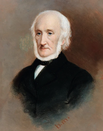 George Petrie, Irish antiquarian and artist.
George Petrie was an Irish antiquarian, artist and collector of traditional music. His research on round towers and the Hill of Tara helped establish him as a leading figure among the early Irish archaeologists.
Artist and Antiquarian
Born in Dublin on 1 January 1790, Petrie was the son of portrait painter James Petrie. He trained at the Dublin Society’s drawing school and travelled through Ireland sketching landscapes and historic buildings. His skill as a draughtsman helped him record monuments in detail and encouraged his interest in their history.
The Ordnance Survey
Petrie organised historical research to accompany the Ordnance Survey maps, connecting buildings and ruins with documentary evidence and local knowledge. In the 1830s he worked with John O’Donovan and Eugene O’Curry on place names and antiquities. The topographical department closed in 1842, but its records preserved valuable information about Ireland’s historic landscape.
Ireland’s Round Towers
Round towers were the subject of competing theories about Ireland’s distant past. Petrie used architectural and historical evidence to argue that they belonged to Christian ecclesiastical communities and served as bell towers. His study also considered their use as places of refuge, challenging explanations that assigned them to pagan or foreign builders.
His essay won the Royal Irish Academy’s gold medal in 1833. The expanded study appeared in 1845 as The Ecclesiastical Architecture of Ireland, Anterior to the Anglo-Norman Invasion, covering early stone churches as well as round towers.
Tara and the Royal Irish Academy
Elected to the Royal Irish Academy in 1828, Petrie helped develop its collections. His investigation of the Hill of Tara earned another Academy gold medal in 1837 and became one of his most influential studies.
Surveying the Hill of Tara
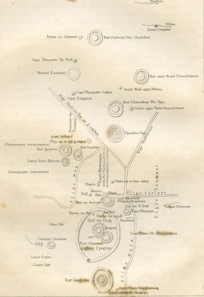 George Petrie’s plan of Tara with traditional Irish monument names.
At Tara, Petrie and his colleagues compared the visible earthworks with descriptions in medieval Irish manuscripts. They sought to identify individual monuments and understand how the mounds, enclosures and other features related to one another.
John O’Donovan’s knowledge of Irish and historical place names was central to this work. The team drew on the Dindshenchas, the medieval literature of place-name stories, which associated Tara’s monuments with kings, legendary figures and ceremonial gatherings. Their identifications shaped accounts of the hill for generations.
Petrie presented On the History and Antiquities of Tara Hill to the Royal Irish Academy in 1837. Originally intended to accompany the Ordnance Survey map of Co. Meath, the study appeared in volume XVIII of the Transactions of the Royal Irish Academy in 1839. Its discussion and plans provided a lasting reference for the study of Tara.
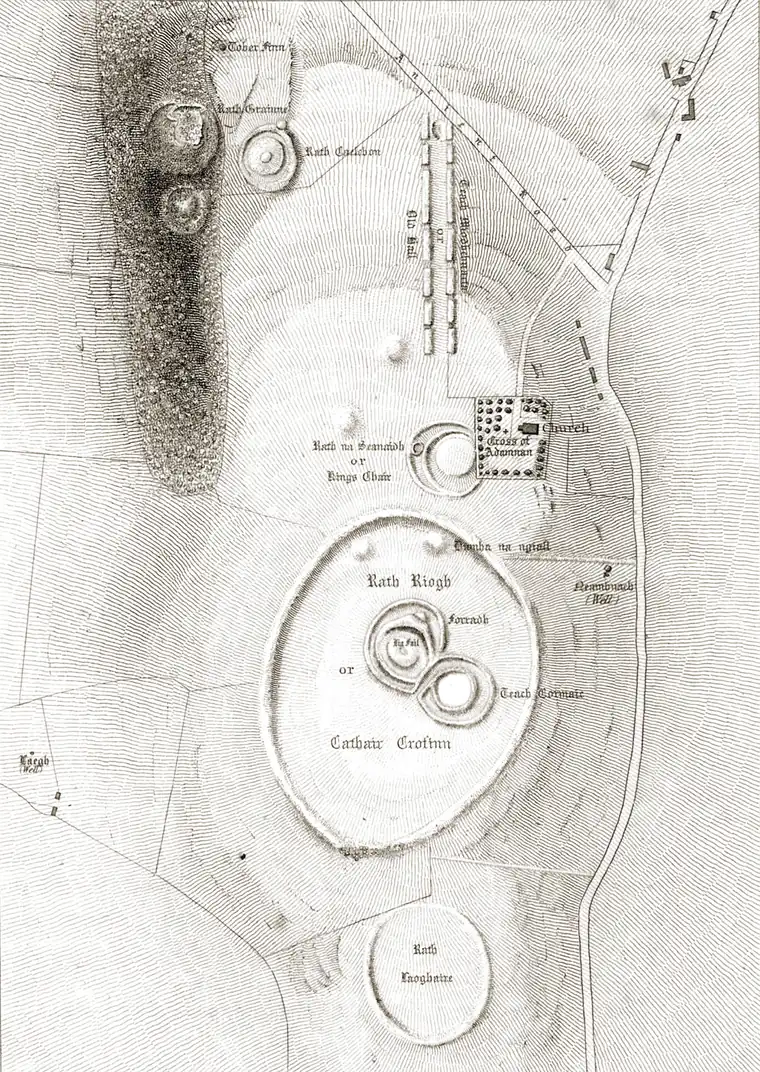 Hill of Tara: the 1837 Ordnance Survey plan based on Petrie’s research.
Hill of Tara 1837 Ordnance Survey Map
The 1837 plan shows Tara’s banks, ditches and mounds. Its older spellings can be compared with the monument names used today:
- Ráth na Ríg: the large oval enclosure in the lower half of the plan, containing the adjoining earthworks of the Forradh and Teach Cormaic.
- Dumha na nGiall: the Mound of the Hostages, marked near the northern edge of the great enclosure. It is a Neolithic passage tomb, much older than the kingship traditions associated with Tara.
- Ráth na Seanadh: the Rath of the Synods, beside the churchyard. Petrie’s plan preserves a record of its earthworks before the destructive searches for the Ark of the Covenant around the turn of the twentieth century.
- Teach Midchúarta: the long, narrow earthwork towards the top of the map, traditionally called the Banqueting Hall.
From Antiquarian Interpretation to Modern Archaeology
The medieval accounts preserve important traditions, but they were written long after many of Tara’s monuments were built. Archaeologists now interpret the so-called Banqueting Hall as a ceremonial avenue rather than the remains of a great feasting hall. Such findings show why traditional names cannot always establish a monument’s original purpose.
Later excavation and geophysical survey have revealed features with little or no surface expression. The Tara Conservation Management Plan’s monument catalogue brings together these discoveries with the surviving earthworks. Petrie’s plans remain valuable records of the hill before later changes, even where their interpretations have been revised.
Traditional Music and Later Life
Petrie’s interest in Irish heritage extended to traditional melodies. The Petrie Collection of the Ancient Music of Ireland appeared in 1855. He died in Dublin in January 1866 and was buried in Mount Jerome Cemetery.