Boyne Valley Landscapes Project
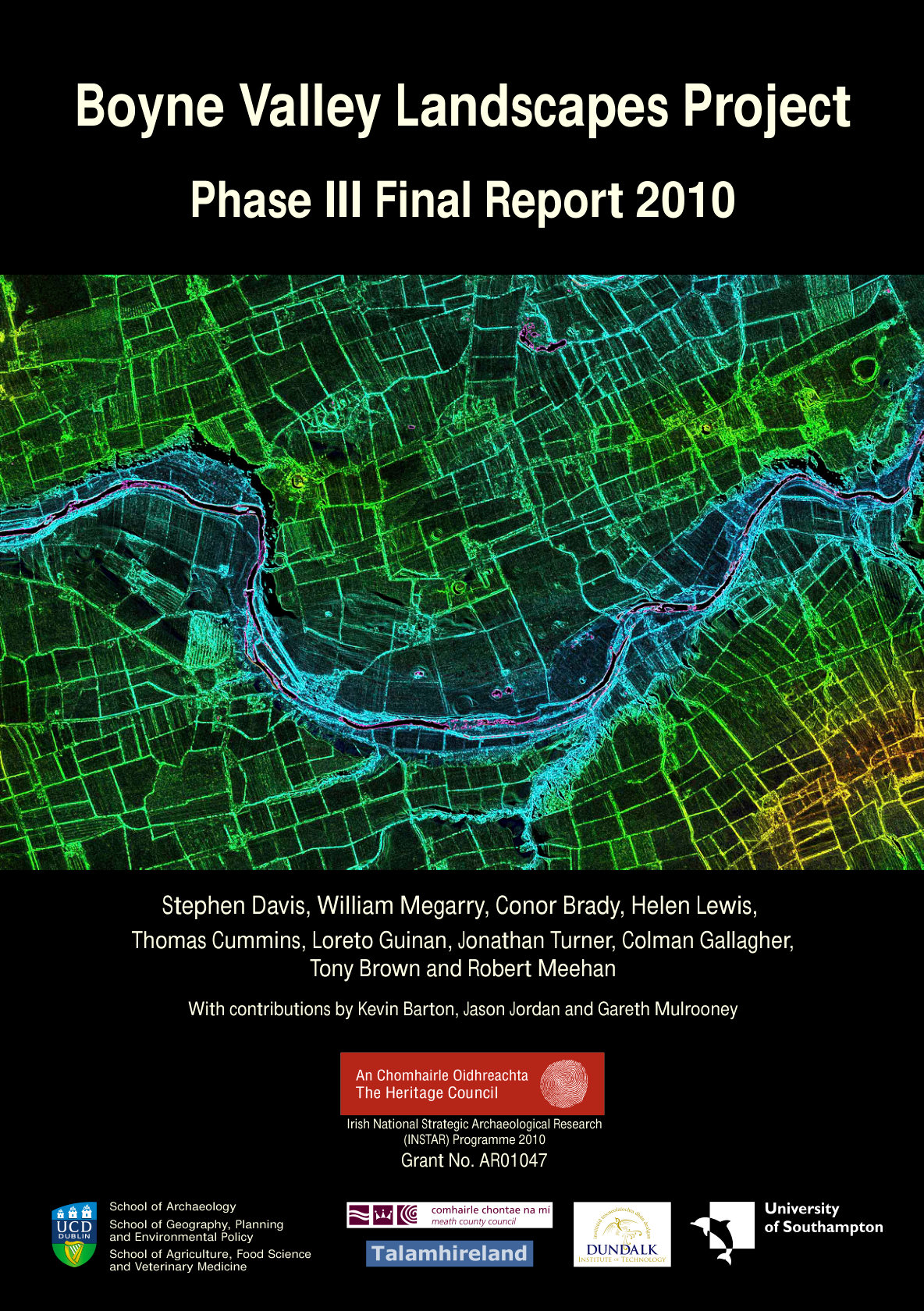 Phase III Final Report, 2010. PDF, 209 pages, 39.5 MB.
The 2010 report examined the Bend of the Boyne as a wider archaeological landscape, looking beyond the three great passage tombs of Newgrange, Knowth and Dowth. The study was led by Stephen Davis, William Megarry, Conor Brady and Helen Lewis, with contributions from Thomas Cummins, Loreto Guinan, Jonathan Turner, Colman Gallagher, Tony Brown and Robert Meehan. Kevin Barton conducted the geophysical survey, while Jason Jordan and Gareth Mulrooney provided specialist reports.
The project brought together researchers from University College Dublin, Dundalk Institute of Technology and the University of Southampton, alongside Meath County Council and Talamhireland. Funding was provided by the Heritage Council through the Irish National Strategic Archaeological Research programme.
Two earlier phases, in 2008 and 2009, had built the GIS and traced the river terraces. This phase stays inside the World Heritage Site. It looks for sites the LiDAR had only hinted at, tests a handful of them with geophysics and asks how Newgrange, Knowth and Dowth stand in view of one another and of the Boyne. The Brú na Bóinne World Heritage Site Research Framework shaped the questions.
What the LiDAR showed
Megarry walked a grid of squares 1 km (0.6 miles) on a side across the LiDAR, checking each square against old and new Ordnance Survey maps, aerial photographs and Google Earth. He marked 127 possible new sites. The list runs from mounds and enclosures to field banks, quarries and hollows that show on the historic maps and not in the Sites and Monuments Record. Each one is graded high, medium or low for a visit, and the gazetteer is printed as an appendix. The sites crowd the bend and thin out with distance, except along the Mattock.
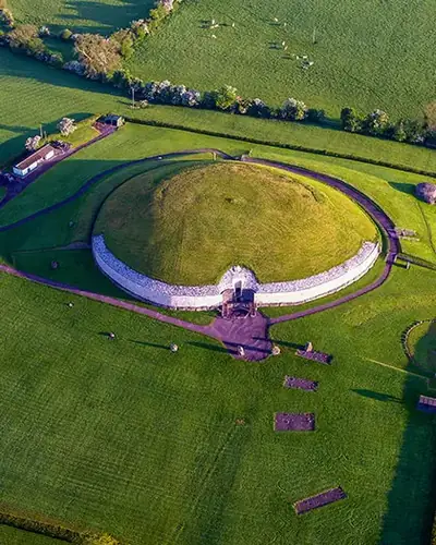 The passage tomb at Newgrange, on the ridge above the Boyne.
Newgrange townland is the heart of the bend. It lies south of Knowth, on the ridge above the river, and it holds the passage tomb the report calls the best known of the three.
Around it are 35 recorded sites, mounds, standing stones and barrows, a looser scatter than the cluster at Knowth.
The mounds are still named from George Coffey's 1912 letter series.
Ten possible new sites showed in the townland. The most complex is LP2, west of Site P and immediately north of the Boyne, a low mound inside a bank with a possible entrance to the east, about 124 by 108 m (407 by 354 feet). A field bank and a narrow road cut it on the west. The authors call it an embanked enclosure, with the warning that LiDAR alone cannot settle what it is.
On the floodplain below the tomb the same survey shows Site B and, beside it, a low oval called Site B1, about 124 by 112 m (407 by 367 feet), with a second circle to the north of B1. At Dowth, LP1 is larger, 151 by 124 m (495 by 407 feet), an inner mound inside a bank with an opening to the east. The surface of these three is much the same. The geophysics, later, is not.
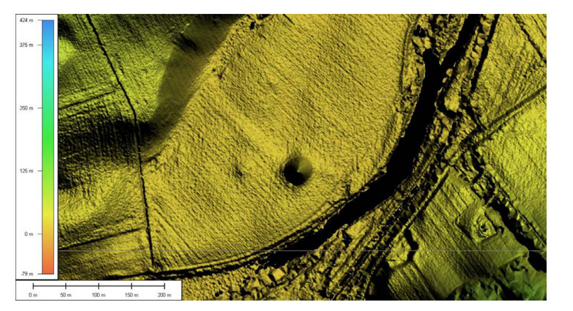 LiDAR of Site B and Site B1 on the north bank of the Boyne. The low ring is the possible enclosure around B1.
The same family of ovals turns up at Dowth Henge, Caulstown, Monknewtown, Site A and Site P. Dowth Henge is about 177 by 170 m (581 by 558 feet). Caulstown, outside the World Heritage Site and south of the cement works at Platin, measures about 179 by 168 m (587 by 551 feet) and is on neither the record nor the old maps.
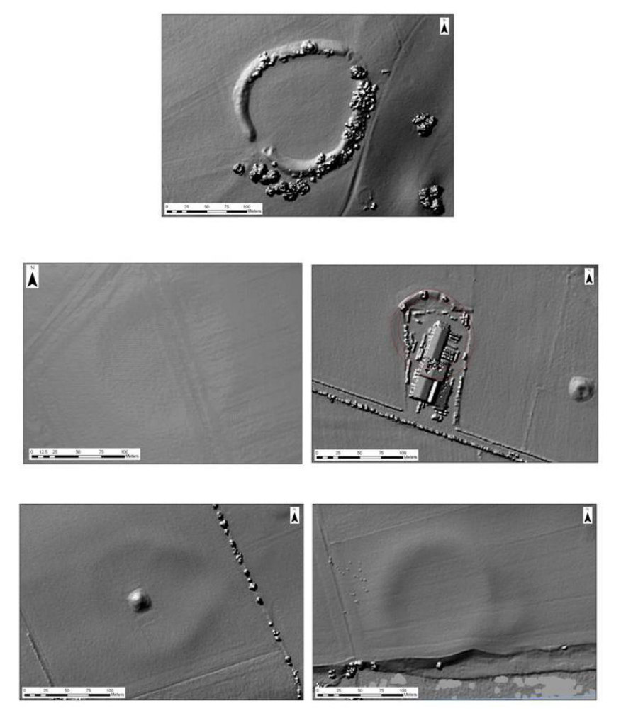 LiDAR of embanked enclosures at Dowth, Caulstown, Monknewtown, Site A and Site P.
A double bank leaves the Dowth passage tomb and runs northwest for more than 1 km (0.6 miles), about 40 m (131 feet) wide, toward the Mattock. It climbs against the slope and bends with the ground, in the manner of a Neolithic cursus. The line is hard to follow, and it may swing back toward Newgrange and Knowth. The report treats it as likely to be a monument because of where it sits and says excavation is the only way to date it.
Southwest of Knowth, on a spur above the river, a new earthwork, their site E5-i, shares the ground of Site N, the recorded promontory fort. The west side may have slipped away. The authors ask for it to be added to the Record of Monuments and Places.
Geophysics on the ground
Barton surveyed four places with magnetometry, earth resistance and, where the ground suggested a cut or a buried hard feature, resistivity sections. At LP2 the magnetic oval matches the LiDAR edge. The circuit is broken, which he puts down either to the plough or to a ring of pits rather than a continuous ditch. A central anomaly, in both the magnetic and the resistance surveys, lies in the raised middle of the oval. Resistance also picked up a feature the magnetometer missed.
LP1, so alike on the surface, is much less clear underground. South of Site M at Knowth, where a coring line had been planned, neither the gradiometer nor the resistivity section found archaeology. Both map the geology. A channel runs along the southwest side of a recorded enclosure, and the curved edge may be erosion rather than a bank. At the Monknewtown pond, Site W in Michael J. O'Kelly's lettering and a ritual pond in the record, the banks look as if they may be partly cored with stone. The pond sits in a hollow. The section does not say whether that hollow was dug.
The view from the river
The viewshed work asks how the three tombs are seen, and what they see. From the river, in the model, a boat coming up from the coast sees Dowth first. All three tombs are visible together only at the base of the bend, for about 1 km (0.6 miles). Farther upstream, Knowth is the last of them still in sight. The river brings a traveller into that view and then takes them out of it. A belt of trees 10 m (33 feet) high along the banks would hide the tombs from the water. A lower screen, 3 m (10 feet) of shrub, was tested as well. The model cannot allow for trees felled on purpose to frame a tomb.
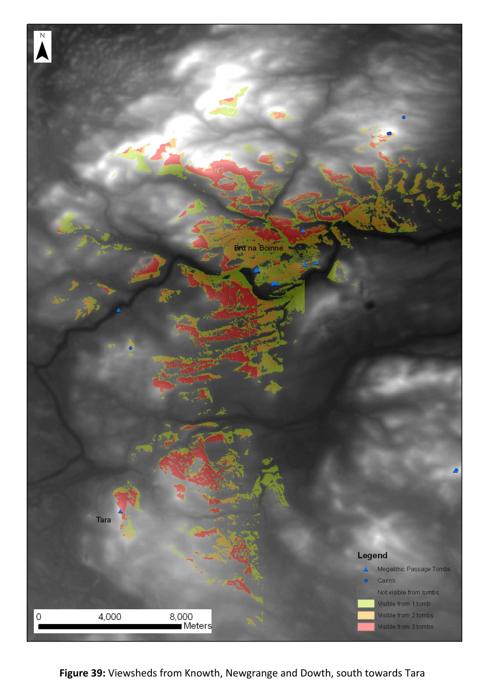 Ground visible from Knowth, Newgrange and Dowth, looking south toward Tara. Red is land seen from all three tombs.
Farther out, the same three tombs are tested against Tara to the south and Loughcrew to the west. The red ground is what all three can see. That shared view holds around the bend and breaks into separate patches once the map leaves the valley.
Cores, a conference and the database
Coring was meant to date more of the fluvioglacial terraces, at Rossnaree, Newgrange, Dowth and Roughgrange, and to sample wet ground that might hold pollen. The environmental chapters cover the Monknewtown pond and a drained basin at Cruicerath. Lewis and Brady say those results were still pending when the report was closed. Remote sensing, they add, does not by itself name a monument or date it. The new sites need a walk-over, more geophysics and, where it is justified, excavation, before they go into the record as certain monuments.
The GIS was rebuilt in 2010 and left at the UCD School of Archaeology, with a public map still to come, through UCD or Meath County Council. Fly-throughs, a solar lighting model and a game made at Dundalk Institute of Technology were tried as ways to show the data. Copies of the digital reports went to the Heritage Council. LiDAR, they argue, should not stop at the World Heritage Site. It should run the length of the Boyne.
Contents
- Introduction and background. Stephen Davis, Conor Brady and Helen Lewis.
- Part 1. Boyne Catchment GIS. William Peter Megarry.
- Previous phases.
- Aims and objectives.
- Data storage, the GIS and outside partners.
- Exploring the LiDAR.
- Visibility analysis.
- Three-dimensional models.
- Putting the data online.
- Conclusions.
- Part 2. Geophysical surveys. Kevin Barton.
- Site LP1, Dowth.
- Site LP2, Newgrange.
- South of Site M, Knowth.
- Site W, Monknewtown.
- Part 3. Palaeoenvironmental work. Conor Brady, Steve Davis and Gareth Mulrooney.
- The ritual pond at Monknewtown.
- Cruicerath.
- Discussion and conclusions. Helen Lewis and Conor Brady.
- Bibliography.
- Appendix I. Gazetteer of new LiDAR sites. William Peter Megarry, with Conor Brady and Steve Davis.
- Appendix II. Moneymore diatom report. Jason Jordan.
- Appendix III. Poster abstract for the Near Surface Geophysics Group conference, London, 2010. Kevin Barton, Conor Brady and Steve Davis.
Read or download the PDF of the 2010 report (209 pages, 39.5 MB).