
Newgrange Site B
Site B is an unexcavated, grass covered mound in the fields below Newgrange, on the north bank of the River Boyne.
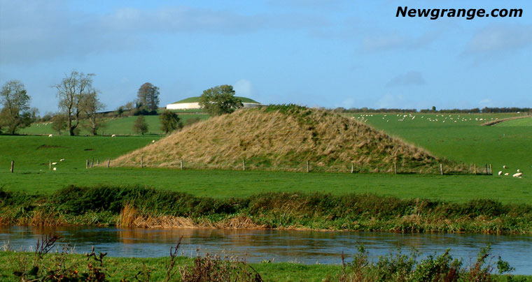 Site B on the banks of the river Boyne with the great Newgrange mound in the background.
From the river the white quartz front of the great passage tomb sits on the ridge behind it. At ground level Site B is a green hill in pasture. No kerb shows at the base, and there is no evidance of an entrance.
A mound by the river
It stands on the lowest terrace of the floodplain, on the eastern side of the bend, in the townland of Newgrange.The National Monuments Service.
The National Monuments reference for Site B is ME019-058001. It describes Site B as a grass covered mound circa 36 m (118 feet) in diameter and nearly 8 m (26 feet) in height, 1 km (0.6 miles) southeast of the main mound at Newgrange Listed as passage tomb by Michael Herity and Claire O'Kelly.
Michael Herity, 1974, page 247, Irish Passage Graves. Dublin.
Claire O'Kelly, 1978 (3rd edition), page 50, Illustrated guide to Newgrange and the other Boyne monuments.
George Coffey identified the mound as Tumulus B on his 1912 map of the Bend of the Boyne. His map also recorded Site A, another large, unexcavated mound on the floodplain, surrounded by an embanked enclosure that has since been largely ploughed away. Michael J. O'Kelly and Claire O'Kelly included both mounds on their map of the Boyne Valley passage tomb cemetery during the Newgrange excavations of 1962 to 1975. Their investigations concentrated on the main passage tomb and damaged satellite monuments, including Sites K and Z, while Site B remained unexcavated.
In 2010, the Boyne Valley Landscapes Project identified Site B as a possible passage tomb and began a geophysical survey of the surrounding area. However, the survey was discontinued following difficulties with the landowner. Following the aerial discoveries made during the exceptionally dry summer of 2018, Tom Condit and Mark Keegan described both Site A and Site B as likely passage tombs. In their 2021 study of the later Neolithic landscape at Brú na Bóinne, Stephen Davis and Knut Rassmann also identified Site B as a probable passage tomb, based on its size, shape and location within the wider cemetery. However, no burial chamber has been identified.
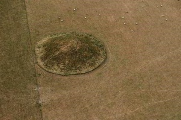 Site B in the dry summer of 2018 - Newgrange from the air.
The Dagda's mound
James Fergusson, in Rude Stone Monuments (1872), described the cemetery along the north bank of the Boyne. In front of Newgrange, lower down and nearer the river, he found a smaller mound "still popularly known as that of the Dagda". Anthony Murphy identifies that mound with Site B. The position fits. Site B is the mound in front of Newgrange and closest to the water.
The medieval tale De Gabáil in tSída, "The Taking of the Síd", tells how the Dagda kept Síd in Broga, the name given to Newgrange, when he shared out the otherworld mounds. His son Oengus asked for the síd for a day and a night. When the Dagda returned, Oengus refused to leave, on the grounds that time itself is made of days and nights. Charles Squire, retelling the story in 1912, said the Dagda then "abandoned the best of his two palaces" to his son. Fergusson's local name is what places the second dwelling at the mound by the river. Fergusson hoped it still held the bones and armour of the Dagda. The archaeological expectation is a Neolithic passage tomb.
Enclosures beside the mound
The exceptionally dry summer of 2018 revealed previously unknown archaeological features across the floodplain at Brú na Bóinne. In July of that year, Anthony Murphy and photographer Ken Williams used drones to survey the landscape around Newgrange. Their aerial photographs revealed the outline of a large Neolithic enclosure, now known as the Geometric Henge or Dronehenge. The prolonged drought had caused differences in crop growth, making buried archaeological features visible from the air. Further cropmarks revealed three enclosures in the grassland near Site B, forming a group on the eastern side of the floodplain. Tom Condit and Mark Keegan subsequently examined these features in the context of the other great enclosures further west, including Site P and the newly discovered Geometric Henge.
Two of the eastern enclosures are large and roughly circular. Condit and Keegan describe both as henges with broad banks and external ditches. The larger enclosure measures approximately 160 m (525 feet) across, with its southern edge following the top of the riverbank. In their 2021 study, Stephen Davis and Knut Rassmann record an internal diameter of 154 m (505 feet), making it the largest henge yet identified at Brú na Bóinne. However, their interpretation of the aerial photographs suggests a ditch without a clearly visible bank. The second enclosure measures approximately 120 m (394 feet) across and lies just 12 m (39 feet) from the first. A low mound is visible within it.
This mound, known as Site B1 (ME019-058002), was identified in a 2010 LiDAR survey as lying off-centre within a low embanked enclosure measuring approximately 124 by 112 m (407 by 367 feet). The aerial photographs taken during the 2018 drought revealed an additional ditch outside the bank. A third, smaller enclosure, approximately 40 m (131 feet) across, lies close to the edge of the next river terrace. Condit and Keegan interpret this feature as having an outer bank, an internal ditch and substantial post-holes. Davis and Rassmann, however, consider it unusually small for an Irish henge and suggest it may instead represent a barrow with an external ditch and a slight mound nearby.
The great passage tombs of Brú na Bóinne were constructed during the later 4th millennium BC, while the henges, timber circles and palisaded enclosures of the floodplain generally date to the early and middle 3rd millennium BC. These later monuments demonstrate that the landscape continued to serve as an important ceremonial and gathering place long after the great passage tombs were built. Site B remains a prominent feature within this complex prehistoric landscape, overlooking the River Boyne with Newgrange rising on the ridge behind it.
Images of Site B
Site B is located on private land on the north bank of the River Boyne. From the south side of the river the mound can be seen rising above the surrounding fields, with the great passage tomb of Newgrange clearly visible on the ridge behind it. This view highlights the relationship between Site B, the river and the wider prehistoric landscape of Brú na Bóinne.
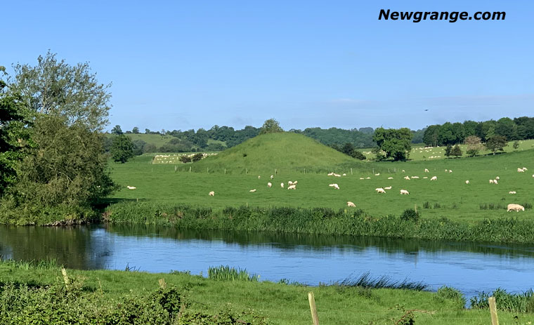 Site B from the south bank of the Boyne.
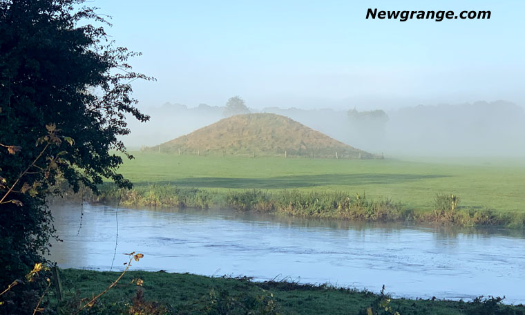 Site B in morning mist, seen across the Boyne.
Brú na Bóinne was inscribed as a UNESCO World Heritage Site in 1993. The inscription covers Newgrange, Knowth and Dowth and the landscape they share. Site B belongs to that landscape, and it is one of the large mounds in the bend that remains unexcavated.